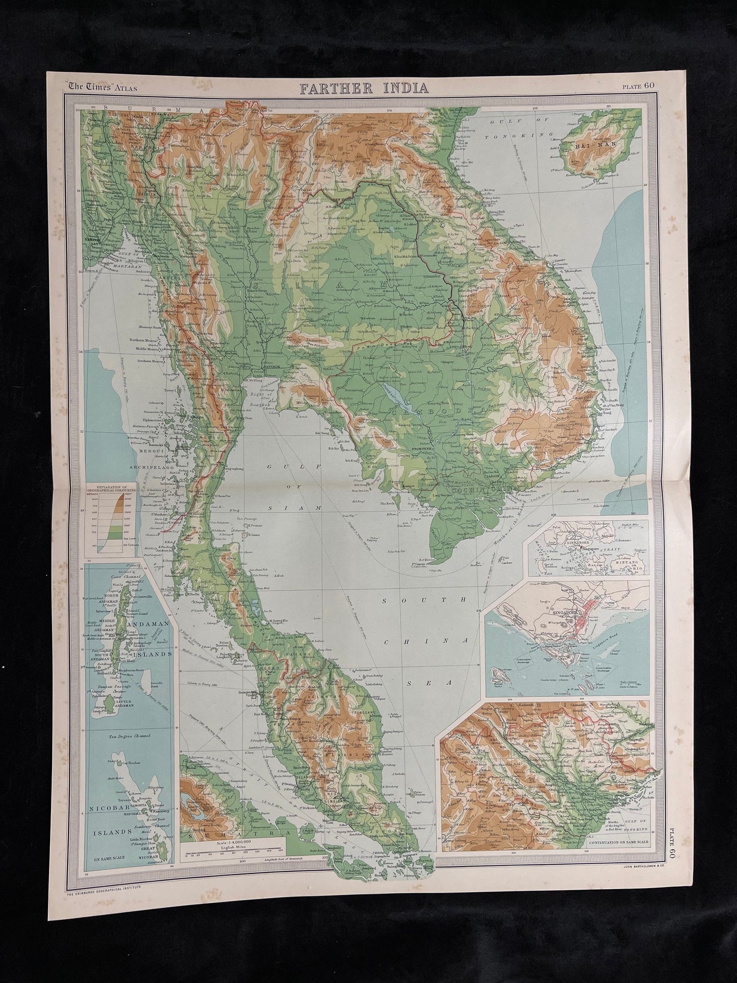
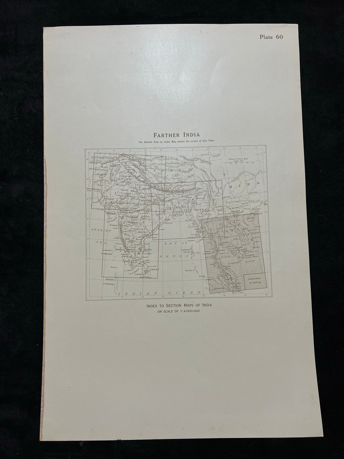
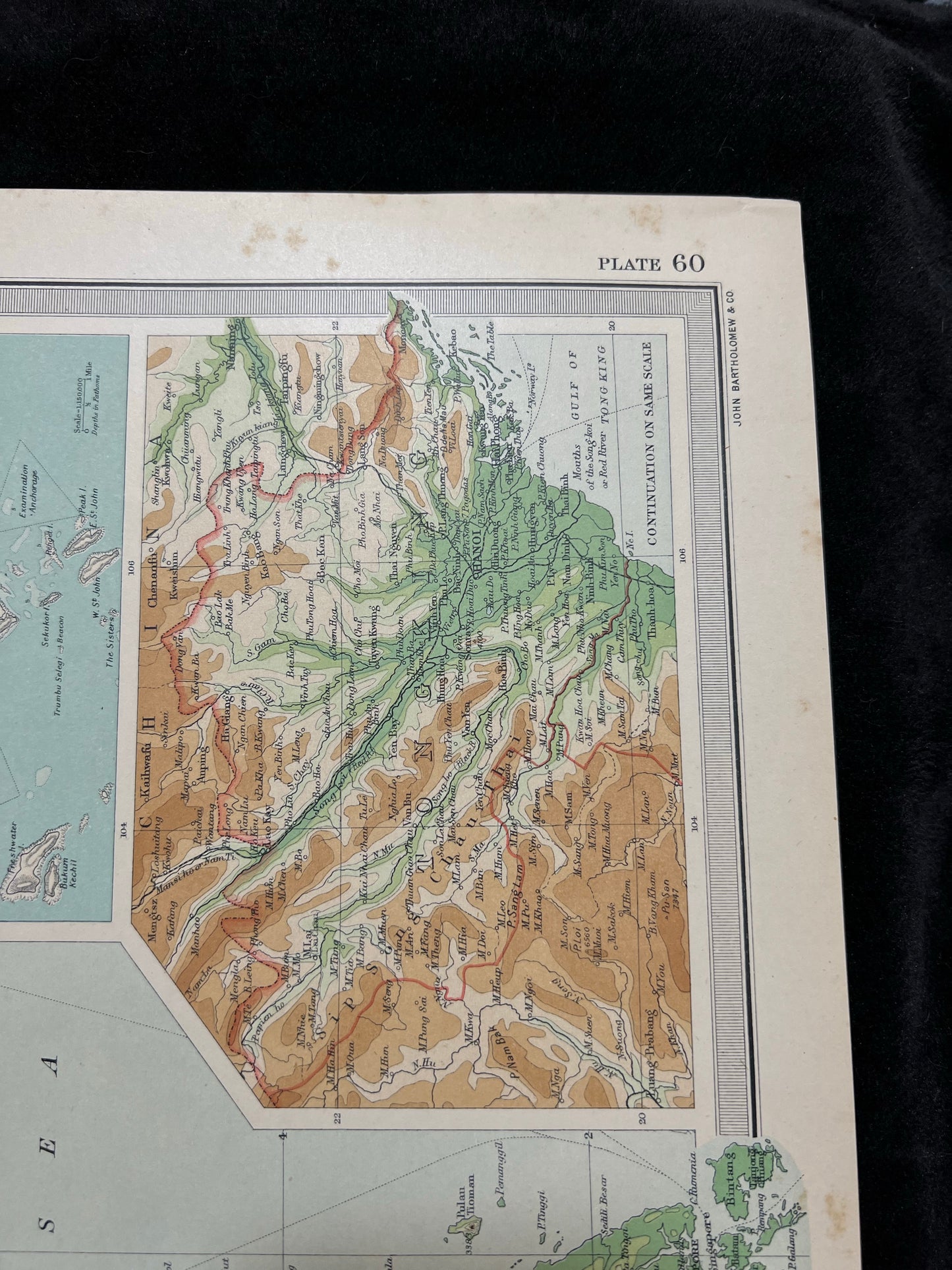
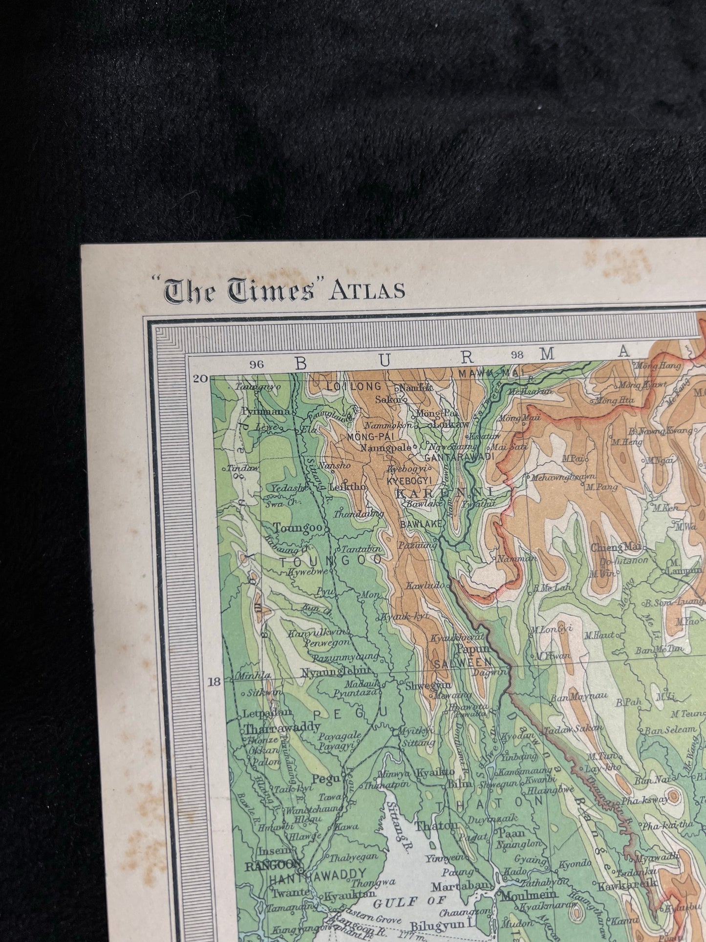
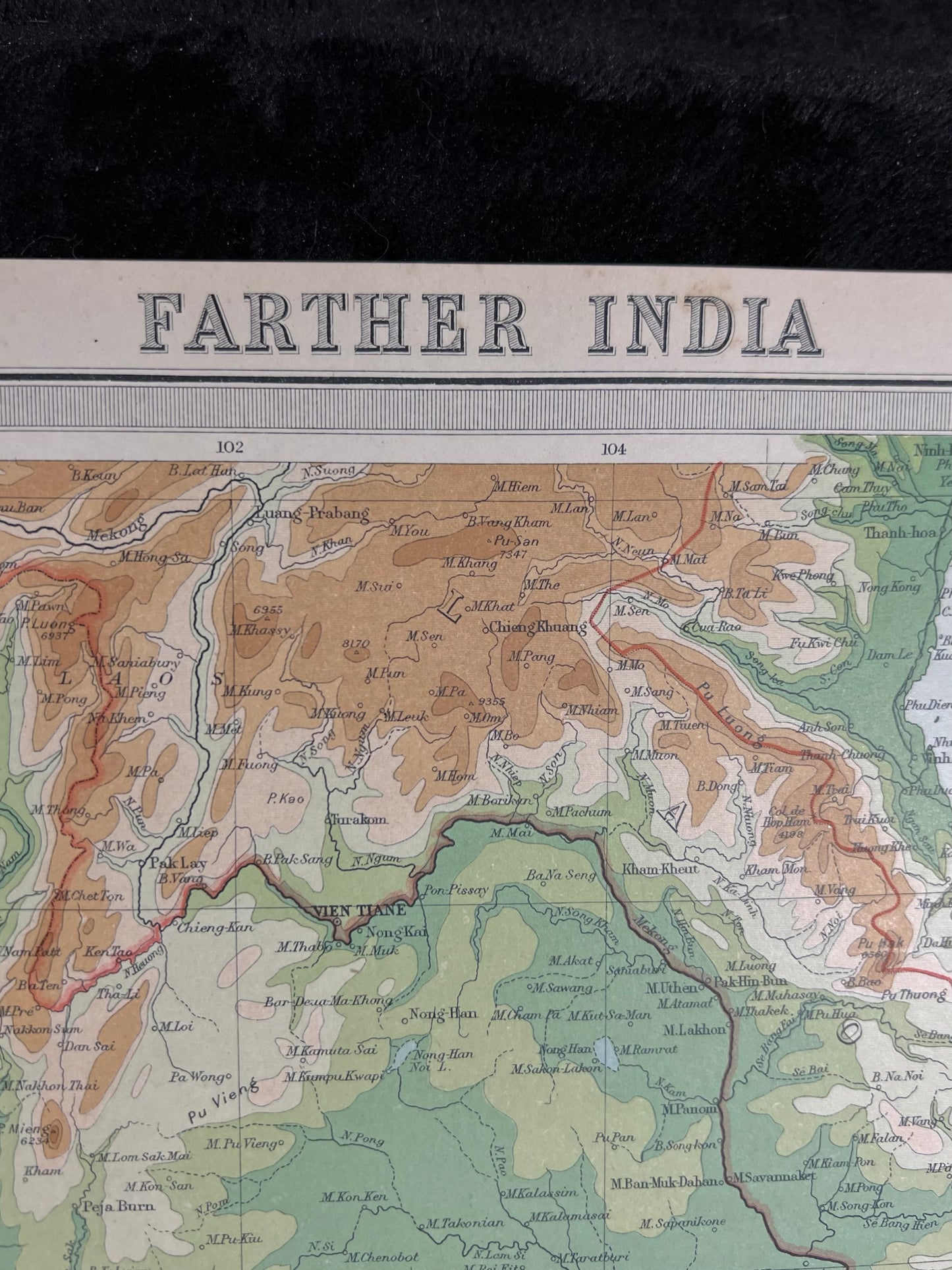
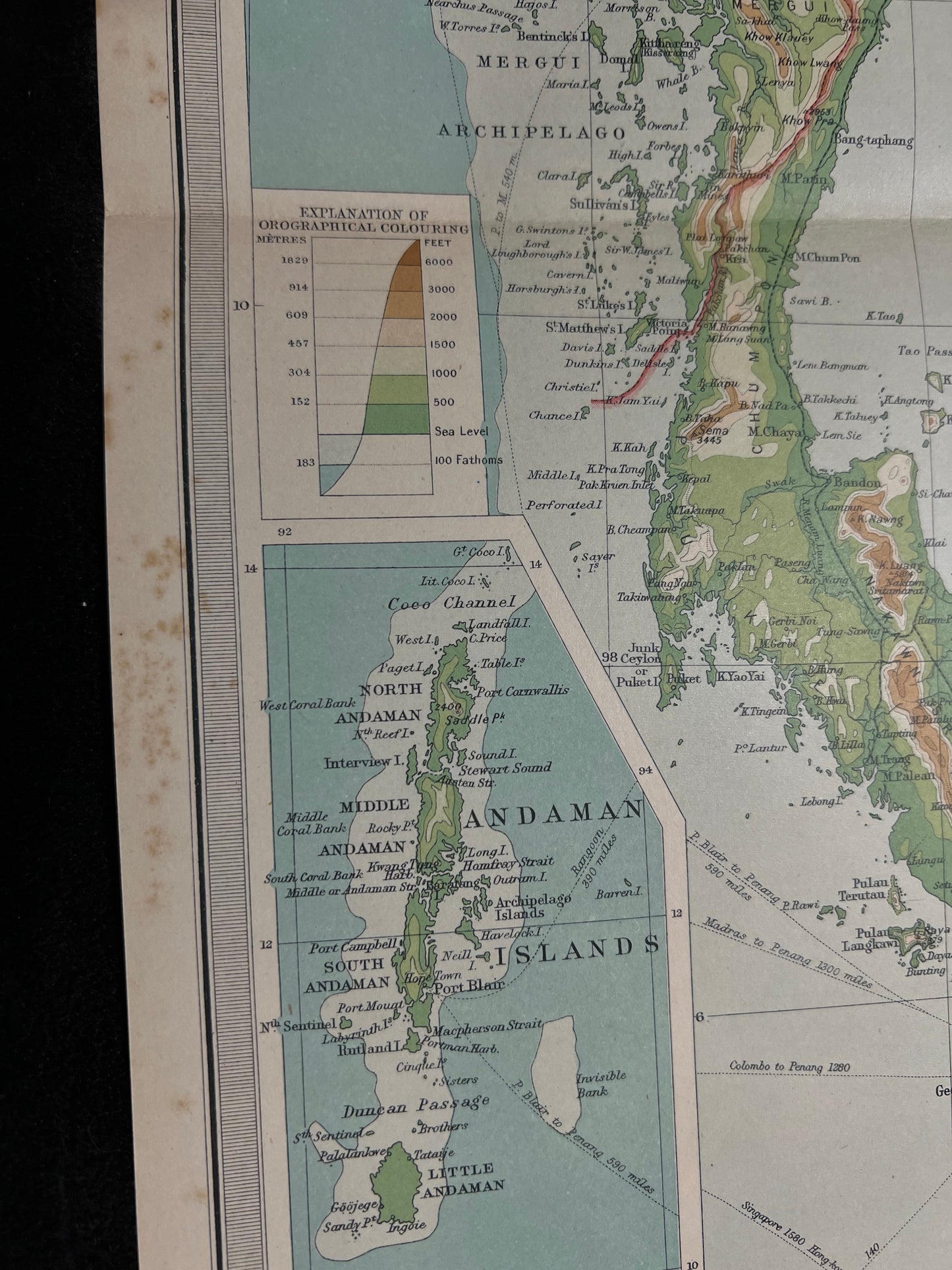
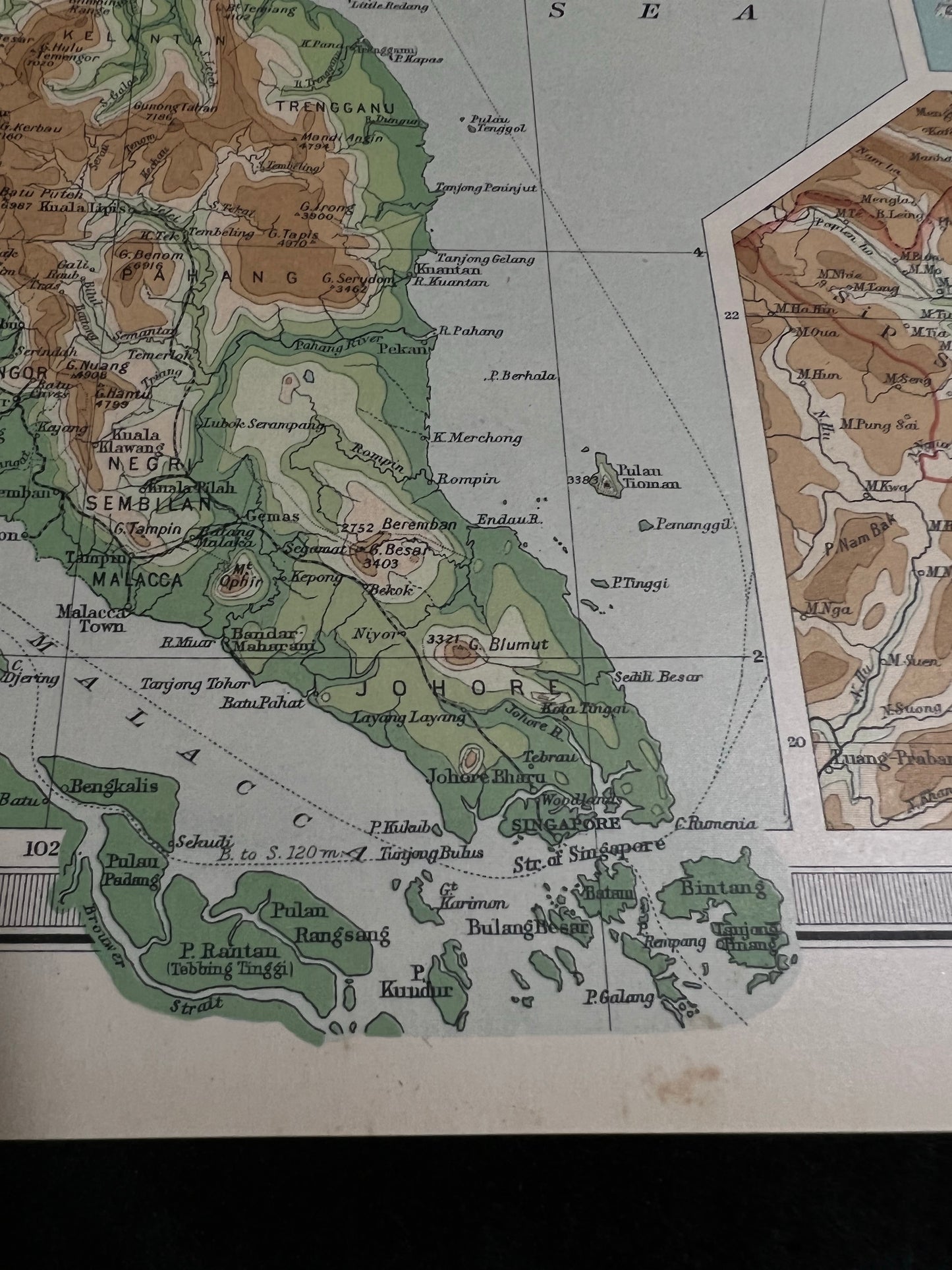
"Farther India" Large Lithograph Maps Published 1922 by The Times, London for "The Times Survey Atlas of the World" Maps by John George Bartholomew of the Edinburgh Geographical Institute. Centre fold as issued. Paper Size: 22.5 x 17.5 inch (57 x 44cm) Good Condition.
The map is printed on one side only and measures 57 cm x 44 cm or 22.5" x 17.5".
If you have any questions or would like to see more photographs then please do not hesitate to ask.