Share
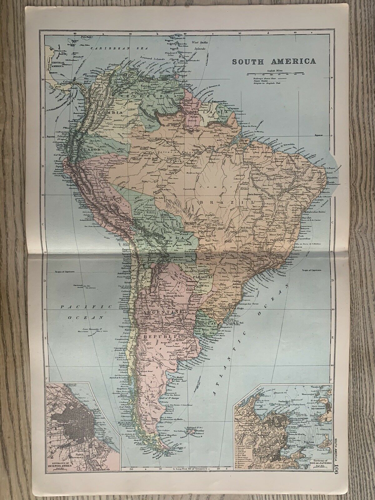
1899 South America Antique Map By G.W. Bacon 121 Years Old
1899 South America Antique Map By G.W. Bacon 121 Years Old
G.W. Bacon
Couldn't load pickup availability
These maps are from The Commercial and Library Atlas of The British Isles From The New Ordnance Survey with Index, Gazetteer, Plans of Towns Also Copious Letterpress Descriptions, Tables of Population, Etc. Edited by G.W. Bacon, published by G.W. Bacon & Co. Ltd, London, 1899. The map is coloured and is printed on one side only and measures:
- South America, British Isles, Ireland, Scotland - 52 cm x 35 cm or 20.5" x 14".
George Washington Bacon (1830-1922) was an American mapmaker and publisher who developed a successful business producing maps of London. In 1861, Bacon founded a series of businesses. He became bankrupt in 1867, after failing to keep on top of managing these businesses. In 1870, Bacon started his business, G.W. Bacon & Co., on 127 Strand, London. He based his atlases on the plates used by Edward Weller for his Weekly Dispatch Atlas. In 1893, he bought the map business of James Wyld.